
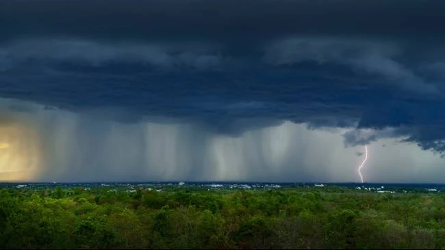
The Indonesian Agency for Meteorology, Climatology, and Geophysics (BMKG) has issued a warning for Papua, saying that from September 3 to 9, 2026, people should be more aware of the weather because large storm clouds called cumulonimbus (Cb) are expected to form over much of Papua and the nearby airspace. The meteorological agency warns that these powerful storm clouds can produce sudden heavy rain, lightning, strong winds, and other hazardous conditions, while aviation operators face an additional risk from severe turbulence.
There is an important detail in the latest BMKG aviation forecast. Papua is listed within the Occasional, or OCNL, category covering 50 to 75 percent of spatial coverage, but Papua is also separately listed in the Frequent, or FRQ, category with coverage above 75 percent for the same September 3 to 9 period. This means the risk picture is not uniform across the province and should be interpreted geographically and operationally rather than as a single weather condition for all of Papua.
The warning arrives only days after severe weather caused damage in Papua’s highlands. In Lanny Jaya, hail damaged agricultural land, while Puncak Regency in Papua Tengah declared a temporary emergency response amid drought, forest and land fires, and hail. The latest forecast therefore carries significance well beyond weather monitoring. It touches food security, transportation, public safety, and the continuity of economic activity across Papua.
Cumulonimbus Is More Than an Ordinary Rain Cloud
Cumulonimbus clouds are among the most powerful weather systems encountered in tropical regions.
They can grow vertically through a large portion of the atmosphere and are commonly associated with thunderstorms, intense rainfall, lightning, gusty winds, and, under certain conditions, hail.
BMKG’s aviation meteorology service specifically describes its CB forecast as an early warning system for extreme weather affecting both aviation and the public. For September 3 to 9, the agency’s map places Papua, Papua Barat, Papua Barat Daya, Papua Pegunungan, Papua Tengah, and Papua Selatan among areas where CB development is expected.
The distinction between the categories is important.
The OCNL category represents spatial coverage of approximately 50 to 75 percent, while FRQ means coverage above 75 percent. These categories describe the potential spatial extent of Cumulonimbus development. They should not be interpreted as meaning that every location inside a province will continuously experience thunderstorms throughout the period.
Weather conditions can change rapidly, particularly in mountainous terrain.
For communities in Papua, that means a calm morning does not necessarily guarantee a calm afternoon or evening.
Sudden Storms Can Develop Quickly
One of the main risks associated with Cumulonimbus clouds is their ability to produce intense weather over a relatively short period.
A storm may bring heavy rainfall after a period of otherwise dry or partly cloudy conditions. Lightning can become a threat to people outdoors, while strong downdrafts can generate sudden changes in wind speed and direction.
BMKG’s recent public weather warnings have specifically advised people to remain alert to locally occurring rain accompanied by lightning and strong winds even while the dry season remains dominant in parts of Indonesia.
For Papua, the combination of tropical atmospheric conditions and complex terrain makes localized forecasting particularly important.
The impact of a storm in a densely populated urban area may differ from its impact in a highland farming community or a remote settlement accessible mainly by air.
That is why the agency’s warning should be treated as a preparedness signal rather than a prediction that every district will experience the same conditions.
Strong Winds Can Become a Hidden Danger
Heavy rain is usually the most visible consequence of a storm, but wind can be just as dangerous.
Strong downward air currents associated with thunderstorms can reach the surface and spread outward rapidly. These winds, commonly referred to as downbursts, can damage roofs, trees, and temporary structures.
In particularly unstable conditions, localized rotating winds can also produce phenomena commonly described as tornadoes or puting beliung.
For residents, the practical response is straightforward: when a strong thunderstorm approaches, people should avoid exposed locations and remain away from trees, weak structures, billboards, and other objects that can fall.
BMKG has similarly advised people not to shelter under trees, billboards, or fragile structures when heavy rain is accompanied by strong winds or lightning.
This message is especially relevant in rural Papua, where communities may spend significant periods outdoors for farming, transportation, or other livelihood activities.
Hail Is a Particular Concern for Highland Agriculture
The latest warning also deserves attention because Papua has recently experienced destructive hail.
In August, three districts in Lanny Jaya were affected by hail that damaged agricultural land. Local authorities reported concerns over crop losses, while emergency teams were established to assess the impact and provide assistance. The unusual phenomenon occurred during a period of dry conditions, prompting additional concern over food availability.
BMKG explained that strong Cumulonimbus development can produce hail when water droplets are carried upward into colder parts of the atmosphere and freeze before falling back toward the surface.
That explanation is particularly relevant to Papua’s highland areas, where elevation can contribute to conditions favorable for hail formation.
The recent Lanny Jaya episode demonstrates why the latest CB forecast should not be treated merely as an aviation issue.
For farming communities, a short period of severe hail can destroy vegetables and other crops that have taken weeks or months to cultivate.
A single storm may therefore create consequences that continue long after the clouds disappear.
Food Security Could Feel the Impact
Agriculture is an important part of household food security in many highland communities.
Tomatoes, vegetables, chilies, and other crops are produced locally and contribute to both household consumption and regional markets.
Damage to crops can therefore have two effects at the same time.
The first is a direct loss for farmers. The second can emerge later through reduced supplies and higher prices.
That connection is particularly important following the recent weather events in Lanny Jaya and Puncak.
In response to the agricultural damage and wider drought conditions, government institutions have already moved food assistance and agricultural support into affected areas. The Ministry of Agriculture, for example, has prepared agricultural equipment assistance for farmers in Puncak, while social affairs authorities have distributed logistical assistance to communities affected by drought and hail.
The latest BMKG warning suggests that preparedness should remain active even as emergency measures continue.
The objective should be to protect both households and the productive capacity of local agriculture.
Papua’s Difficult Geography Adds to the Challenge
Papua’s geography makes severe weather response more complicated than it may appear on a national weather map.
Mountain ranges, forests, long distances, and limited transportation infrastructure mean that reaching an affected community can take considerably longer than in densely populated parts of Indonesia.
In some areas, aircraft provide an essential link.
That creates a direct connection between the CB warning and aviation safety.
Aviation is particularly important in Papua because aircraft connect communities that are difficult or impossible to reach efficiently by road. Flights transport passengers, food, medical supplies, government personnel, and other essential goods.
When severe thunderstorms develop near an airport or along an aircraft’s route, pilots and air traffic managers may need to adjust operations for safety.
Aviation Faces a Different Set of Risks
Cumulonimbus clouds are among the most significant weather hazards for aviation.
The danger is not simply rain.
Aircraft can encounter severe turbulence, strong updrafts and downdrafts, lightning, icing, and rapid changes in wind direction and speed when operating near powerful thunderstorms.
This is why BMKG’s CB forecast is specifically maintained through its aviation meteorology service.
For September 3 to 9, the agency’s official aviation forecast identifies broad areas of Papua and the surrounding seas as potentially affected by CB development. Papua itself appears in both OCNL and FRQ classifications on the forecast page.
The operational implication is not that flights must automatically be canceled.
Instead, airlines, pilots, and aviation authorities use meteorological information to assess routes, departure and arrival conditions, and potential alternatives.
This is especially important for Papua, where a single disrupted flight can have consequences beyond passengers.
Medical transfers, government operations, and the delivery of essential goods can also be affected by aviation disruptions.
The Pacific Side of Papua Is Also Being Watched
The weather situation extends beyond land.
BMKG’s maritime forecast for the northern Pacific waters of Papua on September 3 shows thick cloud conditions and the potential for thunderstorms later in the forecast period. The same forecast records wind gusts that can temporarily increase significantly.
For fishing communities and maritime transport operators, that provides another reason to monitor updates before heading offshore.
The sea may appear relatively calm during one period and become more challenging as convective activity develops.
The same principle applies to small boats operating close to shore.
Weather awareness therefore needs to extend beyond major commercial aviation and shipping. Small-scale fishing and local marine transport are part of everyday economic life in Papua and can be particularly vulnerable to sudden weather changes.
The Warning Comes Amid Broader Atmospheric Activity
The current CB forecast is part of a wider period of active atmospheric dynamics over Indonesia and its surrounding waters.
On September 3, BMKG reported a tropical disturbance identified as Tropical Cyclone Seed 95W over the northeastern Pacific near Papua. The system was associated with convergence, confluence, and a low-level jet extending across several areas of the region. BMKG said these atmospheric features were contributing to increased potential for rain cloud development.
This does not mean that the tropical disturbance itself will directly produce severe weather in every part of Papua.
Weather systems interact with local atmospheric and geographical conditions.
But the development reinforces the importance of following updated forecasts rather than relying on a single forecast issued several days earlier.
For residents, the message is simple: the atmosphere remains dynamic.
Early Warning Is the First Line of Protection
The value of the BMKG warning ultimately depends on how quickly information reaches people who need it.
Weather information has little practical value if it remains inside government offices.
Local administrations, disaster management agencies, schools, airlines, airports, farmers, fishermen, and communities all have different needs, but they share one requirement: timely information.
A farmer needs to know whether severe weather could damage crops.
A fisherman needs to know whether conditions are safe at sea.
An airline needs detailed aviation weather information.
A village government needs to know whether residents may require shelter or assistance.
The national and provincial governments therefore have an important role in translating meteorological warnings into practical preparedness.
That can include ensuring communication channels remain active, checking emergency supplies, and reminding communities what to do during thunderstorms.
What Residents Should Watch For
The warning does not require communities to stop normal activity for an entire week.
Instead, residents should pay attention to rapidly developing clouds, thunder, sudden wind changes, and official weather alerts.
When thunderstorms approach, outdoor activities should be reconsidered. People should move away from exposed areas and avoid standing near isolated tall objects.
Farmers should also monitor crop conditions after severe weather and report significant damage to local authorities.
In highland communities, where hail can occur suddenly, protecting vulnerable agricultural areas, where practical, may help reduce losses.
The most important precaution is not to underestimate a storm simply because it develops during the dry season.
The recent hail events in Lanny Jaya provide a powerful reminder that dry-season conditions and severe convective weather can coexist.
Government Preparedness Has an Economic Dimension
Weather preparedness is also economic policy.
Damage to farms affects food supply. Flight disruptions affect commerce and government services. Strong winds can damage infrastructure. Heavy rainfall can create localized flooding and landslides in vulnerable terrain.
Preparing early can reduce those costs.
Indonesia’s investment in meteorological monitoring therefore supports more than disaster response. It helps communities, businesses, and public institutions make decisions before conditions deteriorate.
For Papua, where logistical costs are already influenced by geography, preventing or minimizing weather-related disruptions can have considerable value.
The ability to move food, medical supplies, and passengers safely is part of the province’s broader development agenda.
A Continuing Role for Provincial Authorities
Papua’s provincial and district governments will remain important in converting BMKG information into local action.
The warning covers several provinces across the Papua region, including Papua Pegunungan, Papua Tengah, Papua Selatan, Papua Barat, and Papua Barat Daya.
But local exposure varies considerably.
A highland farming district may be more concerned about hail and crop damage. A coastal area may focus on thunderstorms and maritime conditions. An urban center may prioritize drainage, falling trees, and public safety.
This is why local governments need to interpret national warnings through local conditions.
The same warning can require different preparedness measures in different parts of Papua.
Lessons From Lanny Jaya Should Not Be Lost
Perhaps the strongest reason to take the current warning seriously is that Papua has already experienced the consequences of severe convective weather this season.
The hail in Lanny Jaya demonstrated how quickly an unusual weather event can move from being a meteorological curiosity to a food security problem.
Communities that watched hail cover the ground may have initially viewed the event as something unusual and temporary.
For farmers, however, the consequences continued after the ice disappeared.
The hail had damaged crops. Emergency assistance became necessary. Government agencies had to assess the situation and organize logistical support.
That experience provides a practical lesson for the coming week.
Preparedness is cheaper and more effective when it begins before a storm arrives.
Conclusion
The latest BMKG cumulonimbus warning for Papua is a reminder that the region’s weather can change rapidly, even during a period when dry conditions remain prominent.
From September 3 to 9, BMKG forecasts Cumulonimbus development across Papua and several surrounding areas. Its aviation forecast places Papua within the OCNL category of approximately 50 to 75 percent spatial coverage, while also identifying Papua in the FRQ category with coverage above 75 percent. This apparently different classification underscores the need to read the forecast geographically and follow its detailed updates rather than treating the entire region as having identical weather conditions.
The potential consequences are significant.
Thunderstorms can bring lightning and sudden heavy rain. Strong downdrafts can produce dangerous wind gusts. More severe convective activity can damage infrastructure and agriculture. Cumulonimbus clouds can also create serious turbulence and other hazards for aircraft.
For Papua’s farming communities, the recent hail damage in Lanny Jaya shows that the risks are not theoretical. For aviation and maritime operators, the warning reinforces the need for careful weather monitoring.
The government’s most important task now is to ensure that scientific forecasts reach communities in a form they can understand and use.
BMKG provides the early warning. Provincial and district authorities, emergency agencies, transport operators, and communities must turn that information into preparedness.
If they do, the September weather outlook can become what an early warning system is supposed to be: not a prediction of disaster, but an opportunity to reduce its impact.
Read Also
Papua Hailstorm Triggers Emergency Response
Papua Barat Hotspots Fall Sharply After Fire Response
Papua Tengah Moves Fast to Contain Forest Fires

