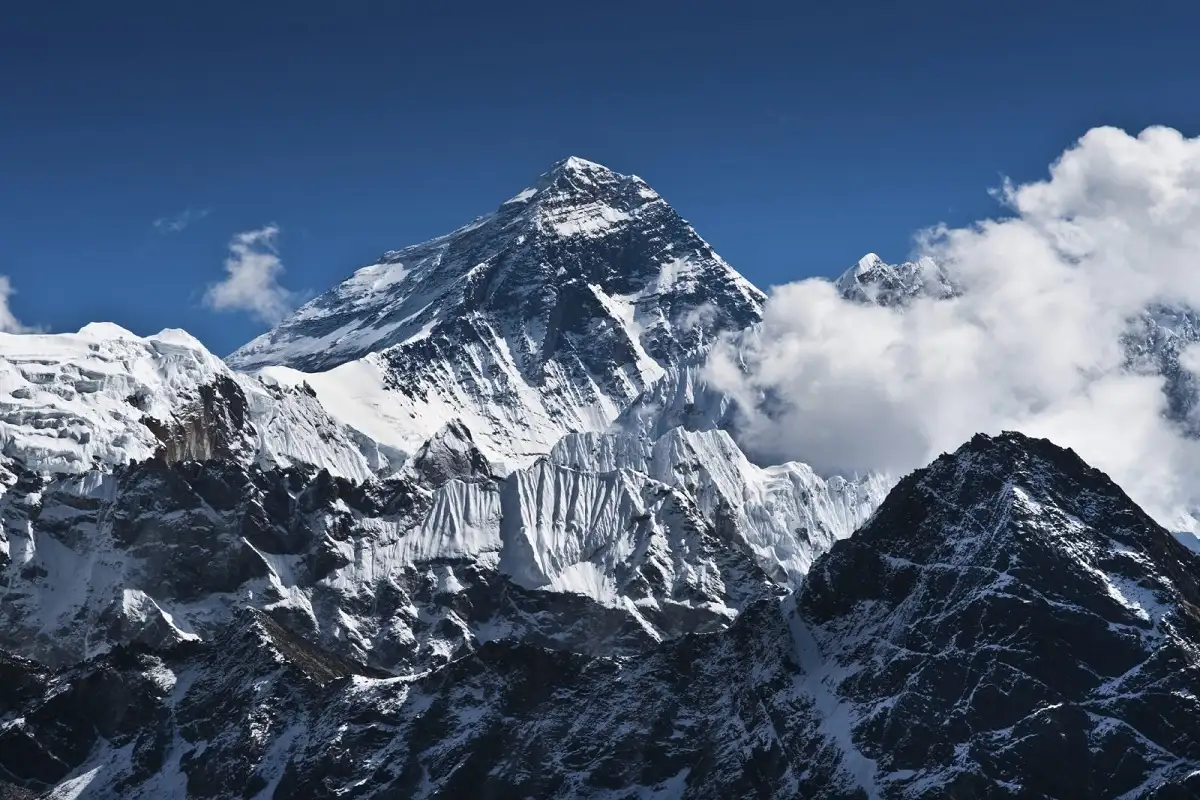
High above the forests of Papua, the sharp limestone walls of Puncak Jaya rise into a landscape that seems out of place on the equator.
There is rock, ice and snow.
At 4,884 metres above sea level, Puncak Jaya, also known internationally as Carstensz Pyramid, is Indonesia’s highest mountain and the highest summit in Oceania. Its glaciers have also made the mountain one of the world’s most unusual natural landmarks. Yet the white landscape that once covered a much larger part of the mountain is rapidly disappearing.
The story of Puncak Jaya’s glacier is no longer simply about mountaineering or adventure. It has become a record of environmental change.
Among the remnants is the East Northwall Firn, a glacier system on the slopes of the Carstensz massif. Recent research indicates that the glacier has retreated dramatically, leaving only a fraction of the area that existed more than a century ago. In November 2025, the East Northwall Firn was measured at about 0.09 square kilometres and remained in a state of retreat.
For Papua, Indonesia and the wider scientific community, the disappearance of these glaciers would mean more than the loss of a spectacular landscape. It would remove one of the rare natural records of climate change from the equatorial highlands.
A Mountain That Defied Expectations
Long before satellite images documented the retreat of its glaciers, Puncak Jaya was already a geographical mystery.
In 1623, Dutch explorer Jan Carstenszoon became the first European known to report seeing glaciers on the mountain. His account of snow near the equator reportedly drew ridicule in Europe.
The mountain eventually became known internationally as Carstensz Pyramid, after Carstenszoon.
But the mountain had another identity long before European explorers arrived.
The Amungme name recorded for the peak is Nemangkawi Ninggok, translated as the “Peak of the White Arrow.” Puncak Jaya is the Indonesian name, while Carstensz Pyramid remains widely used among international mountaineers.
The different names reflect layers of history surrounding the mountain, from Indigenous knowledge and local geography to European exploration and modern Indonesian administration.
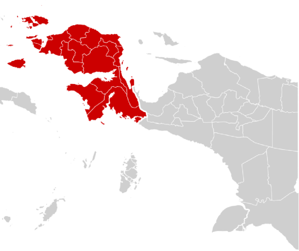
Geographically, Puncak Jaya stands in Mimika Regency, Central Papua Province, within the Sudirman Range. It is part of the broader high mountain environment associated with the Jayawijaya range.
Its elevation gives it an extraordinary distinction.
At 4,884 metres, it is Indonesia’s highest summit and the highest point in Oceania. Its height has also placed it on versions of the Seven Summits list, making the mountain a major objective for climbers from around the world.
Why Snow Exists on the Equator
For international readers, perhaps the most surprising feature of Puncak Jaya is not its height but its location.
The mountain lies close to the equator, an area normally associated with warm temperatures and tropical rainfall.
Yet at nearly 5,000 metres, temperatures are low enough for the glacier to survive.
The result is an unusual tropical glacial environment.
Detik reported that Carstensz was among a small number of locations around the equator where snow has historically been found, alongside high mountains in Africa and the Andes. The presence of tropical snow and glaciers has made Carstensz a rare geological and climatic feature.
The Puncak Jaya region once contained several glaciers, including the Carstensz Glacier, East Northwall Firn, West Northwall Firn and Meren Glacier.
Today, that landscape is dramatically different.
The Meren Glacier disappeared around the late 1990s. Other glacier bodies, including the West Northwall Firn and Southwall Hanging Glacier, have also disappeared. Modern research identifies the remaining glacier around Puncak Jaya mainly as the East Northwall Firn and the Carstensz Glacier.
The change has occurred within a period short enough to be documented through photographs, field expeditions and satellite imagery.
The East Northwall Firn: A Glacier in Retreat
The East Northwall Firn sits at roughly 4,750 metres, about 2.5 kilometres northwest of Puncak Jaya.
It was once part of a much larger Northwall Firn system.
Historical research shows that sometime between the 1930s and early 1960s, the original Northwall Firn separated into eastern and western sections. These became known as the East Northwall Firn and West Northwall Firn.
The division did not mark the beginning of the glacier’s decline. It was already losing glaciers.
A series of expeditions and satellite observations have since provided a long record of retreat.
Research published in The Cryosphere in 2025 found that the total glacierised area around Puncak Jaya fell from about 19.3 square kilometres in 1850 to 6.4 square kilometres in 1974 and 2.15 square kilometres in 2002.
By 2023, only about 0.214 square kilometres remained.
In 2024, the total area fell further to approximately 0.165 square kilometres. Researchers calculated that the remaining glacier area was less than 1 per cent of the estimated 1850 extent.
The East Northwall Firn has been among the most rapidly changing parts of this remaining glacier landscape.
Between 2018 and 2024, its glacier area declined by approximately 0.228 square kilometres, compared with a loss of about 0.074 square kilometres for the Carstensz Glacier. Researchers noted that the East Northwall Firn lost more glacier partly because some of the disappearing sections were located at lower elevations.
By 2024, the western section of the East Northwall Firn had become particularly small, measuring about 0.022 square kilometres.
Satellite analysis indicated that this section was likely to disappear first among the remaining glacier areas.
A Glacier Reduced to Fragments
The glacier’s structure also reflects this transformation.
The East Northwall Firn has not simply become smaller. It has become fragmented.
Recent observations found that the westernmost section had disappeared, while the main body had separated into distinct sections.
Measurements published from satellite imagery show the East Northwall Firn declining from about 348,856 square metres in 2018 to 163,413 square metres in 2023 and 120,812 square metres in 2024.
Another measurement published for November 2025 placed the glacier’s remaining area at around 0.09 square kilometres, with a central patch measuring about 360 metres in length. The glacier is classified as retreating.
These numbers are important because they show that the change is not merely a visual impression.
It can be measured.
It can be mapped.
And it can be followed over time.
From Expedition Records to Satellite Images
The history of Puncak Jaya’s glaciers has been reconstructed through several generations of scientific observation.
The 1936 Carstensz expedition documented extensive glaciers around the mountain. Later Australian-led expeditions in the early 1970s carried out broader surveys of the remaining glaciers.
Those surveys recorded a substantial decline in total glacier area between 1936 and the 1970s.
Satellite technology later allowed researchers to monitor the changes more consistently.
By the 1980s, satellite imagery was already showing further contraction. Later high-resolution observations revealed that the decline continued through the 1990s, 2000s and 2010s.
The development of modern satellite monitoring has changed how researchers understand the mountain.
Researchers can still measure a glacier that is physically difficult to reach from space.
That is particularly important in Puncak Jaya, where difficult terrain, weather and limited access make repeated field surveys challenging.
Researchers studying the remaining glacier have therefore combined satellite imagery with field observations and historical photographs to reconstruct the mountain’s changing landscape.
Global Warming Leaves a Local Signature
The retreat of Puncak Jaya’s glaciers is part of a broader pattern affecting tropical glaciers around the world.
Researchers studying the Carstensz glaciers have linked the long-term decline to a changing climate.
The scientific record shows that glacier retreat has continued for well over a century, but the remaining glacier has now become extremely limited.
An earlier BMKG assessment reported a glacier thickness decline of roughly 2.5 metres per year from 2016 to 2022. The same publication said the glacier area had reached only about 0.23 square kilometres in 2022.
More recent scientific research gives the story a wider historical context.
The 2025 Cryosphere study found that the long-term retreat of tropical glaciers on Puncak Jaya has continued into the most recent observation period, leading to the conclusion that these glaciers are approaching extinction.
The precise timing of complete disappearance remains uncertain.
That point matters.
Earlier projections suggested that some remaining glaciers could disappear during the 2020s. More recent satellite-based research has produced different estimates for individual glacier remnants. One 2026 study, for example, estimated that East Northwall Firn could disappear around 2028 to 2029, while the Carstensz Glacier could persist somewhat longer.
This means that a prediction such as “the ice will disappear in 2026” should be treated as a historical projection rather than an established deadline.
The Human Story Behind the Glacier
Puncak Jaya is not only a scientific site.
It is also part of the human landscape of Papua.
The mountain has long been associated with Indigenous communities, particularly the Amungme and Moni peoples, while the surrounding highlands have their own histories, cultural traditions and relationships with the natural environment.
Many science articles’ publications describe Carstensz as both a geological landmark and an important part of Papua’s identity. It also highlights the mountain’s role within the wider landscape of Papua and the challenges of administering and reaching communities across difficult terrain.
The loss of permanent glaciers therefore raises questions that go beyond climate science.
What happens to tourism when one of the world’s most unusual mountain landscapes loses its snow?
How should future generations document a landscape that is changing within decades rather than centuries?
And how can scientific monitoring, conservation and local knowledge work together?
These are practical questions for Papua’s future.
A Mountain That Challenges Climbers
Long before climate researchers began measuring glacier retreat, Puncak Jaya attracted climbers because of the technical difficulty of reaching its summit.
The first successful ascent of Puncak Jaya took place in 1962, when an expedition led by Austrian mountaineer Heinrich Harrer reached the summit.
The team also included Philip Temple, Russell Kippax and Albertus Huizenga.
Temple had extensive experience in the region and had previously explored routes to the mountain. His knowledge of the terrain proved important to the expedition.
A year later, an Indonesian expedition known as the Cendrawasih Expedition reached the summit. Fred Athaboe, Sudarto and Sugirin were among the Indonesian climbers associated with that historic ascent.
The mountain remains technically demanding.
Unlike many trekking peaks, the standard ascent involves steep rock, fixed ropes and technical climbing skills. Weather can change quickly, adding another layer of risk.
In March 2025, the death of Indonesian climbers Lilie Wijayati Poegiono and Elsa Laksono from hypothermia during their descent once again highlighted the dangers of the mountain. Other members of their group also experienced hypothermia but survived.
The incident underlined an important reality.
Even as the glaciers disappear, Puncak Jaya will remain a high-altitude environment where weather and terrain can be dangerous.
Tourism, Science and Conservation
Puncak Jaya’s international reputation gives Papua a distinctive position in global adventure tourism.
It is one of the mountains associated with the Seven Summits challenge, attracting climbers seeking one of the world’s most technically demanding high-altitude objectives.
Its unusual combination of tropical forest, limestone cliffs and equatorial glacier also gives it scientific value.
For researchers, the remaining glaciers function as natural climate archives and indicators.
For tourists, they represent an extraordinary landscape.
For local communities, the mountain is part of a much broader cultural and geographical environment.
For Indonesia, the site is also part of the country’s natural heritage.
The challenge ahead is to ensure that tourism and research do not become separated from conservation.
The government, conservation authorities, researchers, local communities and tourism operators all have roles to play in documenting and managing the mountain responsibly.
Puncak Jaya is already part of the Lorentz National Park landscape, one of the country’s most important protected areas. Many science articles published describe the area as both a destination for mountaineering and a natural laboratory for studying climate change and biodiversity.
What Papua’s Last Tropical Glacier Can Teach the World
The disappearance of a glacier in a remote mountain range can seem distant from everyday life.
But Puncak Jaya tells a different story.
Its glacier has been photographed by explorers, measured by scientists, climbed by mountaineers and observed by local communities for generations.
The historical record now shows an unmistakable transformation.
From an estimated 19.3 square kilometres of glacierised area around 1850, the Puncak Jaya’s glacier landscape had fallen to roughly 0.165 square kilometres by 2024.
That is not simply a change in scenery.
It is a record of environmental change compressed into a single mountain.
The newer scientific evidence reinforces that concern, while also showing why exact disappearance dates should be treated cautiously.
Conclusion
Puncak Jaya remains a remarkable contradiction of geography.
It stands close to the equator but rises high enough to sustain glaciers. It is surrounded by tropical landscapes yet carries the visual character of a high-latitude mountain. It is a destination for international climbers, a subject of scientific research and a significant part of Papua’s natural and cultural landscape.
But the glacier is no longer stable.
The East Northwall Firn, once part of a much larger glacier system, has been reduced to fragmented remnants. The wider Puncak Jaya glacier area has fallen by more than 99 per cent from its estimated mid-19th-century extent.
The story also carries an important lesson about climate science.
Predictions can change as new observations become available. Earlier estimates placed the disappearance of Papua’s remaining glacier within the 2020s, while newer studies suggest that individual remnants may survive into the latter part of the decade. The direction of change, however, is much clearer than the exact date.
The glaciers are retreating.
For Indonesia, protecting the surrounding mountain environment, supporting scientific observation and developing responsible tourism can help preserve the ecological and cultural value of Puncak Jaya even as global warming continues to reshape its glacier.
For the rest of the world, the mountain offers something equally important: a visible record of how a global warming reaches even the most remote corners of the planet.
One day, the last patch of tropical glacier may disappear from Puncak Jaya.
When that happens, the mountain will remain.
The photographs, scientific records and memories of its snow will remain too.
But the landscape itself will have crossed a line that cannot easily be reversed.
Read Also
Cartensz Peak’s Eternal Snow Continues to Melt, Predicted to Disappear in 2026
Papua Glacier Nears Disappearance Amid Global Warming
Papua Hailstorm Triggers Emergency Response